|
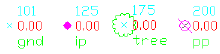
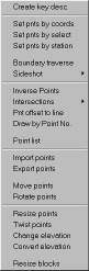
Set points |
|
Set points by entering Northing & Eastings or pick a point. (if you pick
a point on a 3D object, the elevation will be used for the point). You
may also set points by entering a station and offset. |
|
Automatic Linework and point symbols! |
|
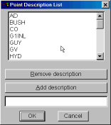
Note: Whenever you add points to the drawing a user definable block can
also be placed there automatically, such as an iron pipe or a power pole
etc. Linework may also be imported from field codes. |
|
|
|
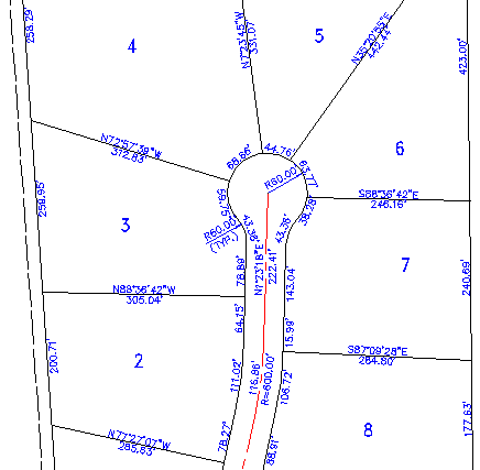
Boundary Traverse and Sideshot |
  |
|
Set points using a boundary traverse or sideshot with turned angle,
North azimuth or South azimuth (use vertical angle or difference in
elevation). |
|
Radial stakeout |
|
Select the points you need for a radial stakeout. Create a radial
stakeout report using Turned Angle or North or South Azimuth. |
|
Inverse |
|
Inverse points by entering the point number. |
|
Intersections |
|
Find intersections by Bearing - Bearing, Bearing - Distance, Az - Az, Az
- Distance, Distance - Distance, Line - Arc, and Point offset to a line. |
|
Draw by point number |
|
You may draw a line from point to point by entering the point number. |
|
Import / Export |
|
Import points from an ascii file or export points to an ascii file. A
file is created with Point Number, Northing, Easting, Elevation and
Description. You may also create a Point List for viewing in the same
format. |
|
Manipulate points |
|
You may manipulate points in the drawing by moving or rotating them, you
may change the elevation of a group of points, you may resize existing
points in the drawing and you may also pivot the points about their
placement point. |
|
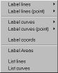
Labels |
|
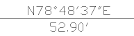
You may label the bearing (or North or South Azimuth) and distance of a
line by selecting it or by picking points. You may label a curve
(radius, length)? or (delta, radius, tangent, length and chord bearing &
length) by selecting it or by picking points.
Label coordinates by picking a point.
Label areas by selecting a closed polyline.
Label station and offset from an alignment (line, polyline or arc). |
|
 |
|
Listing |
|
You may list the bearing and distance of a line by selecting it.
You may list a curve (delta, radius, tangent, length and chord bearing &
length) by selecting it. |
|
Compute Areas |
|
You may let the program automatically compute lot areas by Slide Bearing
or Radial methods. |
 |
 |
 |
 |
|
|
|
Drafting Aids |
|
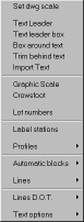
To help you in creating your drawing, we offer a collection of drafting
aids. You may import a text file, insert a graphic scale or place
crowsfeet on a line. You may Label stations on an alignment, create a
profile coordinate system, label elevations by picking and extract a
profile from 3d faces or from 3D lines. You may place text in a line or
find and replace text in the drawing. |
|
 |
|
CADian |
CADD 2008 |
CADian MECH
CADian Architectural |
CADian ARCH |
CADian electcad
CADian/Mech-Q Piping |
CADian/Mech-Q HVAC Ducting
|
CADian/Mech-Q Structural
CADian/Mech-Q BOM Prol |
Survey/Cogo |
CADian Road
Digital Terrain Modeling
|
CADian Viewer |